Long-Endurance Drone Platform With Power-Line-Level Obstacle Sensing

DJI Matrice 400
Engineered for Excellence, Designed for Versatilityz
Long-Endurance Drone Platform With Power-Line-Level Obstacle Sensing
Engineered for Excellence, Designed for Versatilityz
DJI Matrice 400, the enterprise flagship drone platform, boasts an impressive 59-minute flight time [1], a payload capacity of up to 6 kg [2], and integrated rotating LiDAR and mmWave radar for power-line-level obstacle sensing [3]. It also supports the O4 Enterprise Enhanced Video Transmission and Airborne Relay Video Transmission [4], ensuring safer handling and easier operations. Combining Smart Detection with visible and thermal imaging, AR projection, ship-based takeoff/landing, and advanced automation, Matrice 400 excels in emergency response, power inspections, mapping, and AEC.
Extended Flight Time, High Speed Performance

Enhanced Intelligence and Efficiency
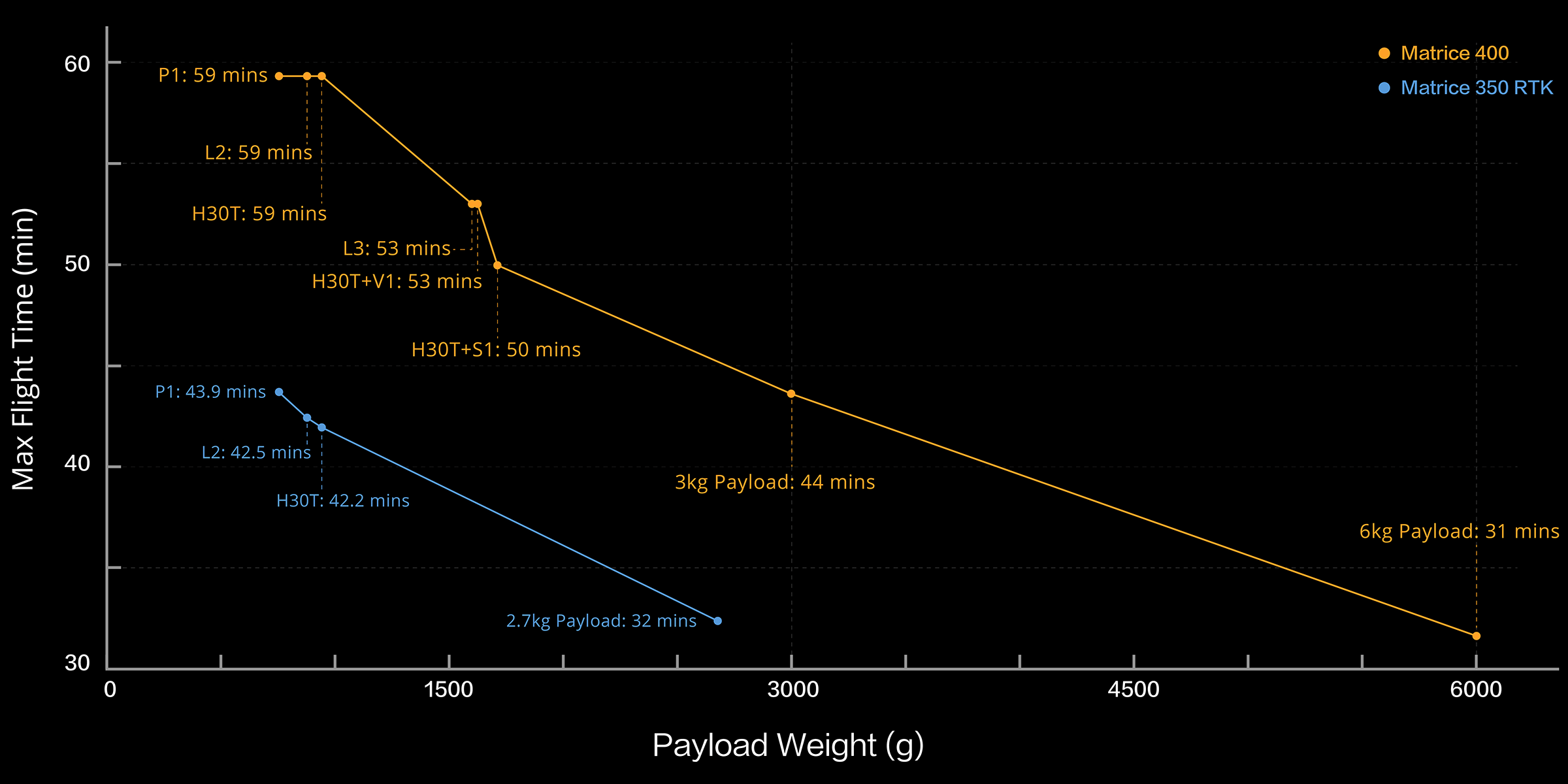
Matrice 400's flight capabilities are outstanding, offering up to 59 minutes of forward flight time even with a payload, and up to 53 minutes of hovering duration [6]. These capabilities make it a reliable tool for long-duration and continuous operations such as search and rescue, firefighting, and large-scale mapping. It can also avoid large obstacles [3] like buildings and mountains at flight speeds of up to 25 m/s.
Matrice 400’s strong payload capacity allows it to easily meet the demands of a wide range of applications. With a maximum payload capacity of 6 kg [2], Matrice 400 supports seamless switching between a single downward gimbal [8] and a dual downward gimbal [8]. It also features a third gimbal connector on the underside for additional flexibility. The aircraft is equipped with 4 external E-Port V2 ports [7], enabling simultaneous mounting of up to 7 payloads.
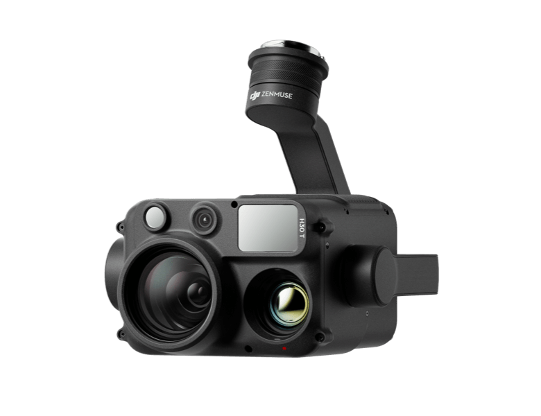
Zenmuse H30 Series[8]
The Zenmuse H30 Series integrates five major modules—a wide-angle camera, a zoom camera, an infrared thermal camera, a laser range finder, and an NIR auxiliary light. Employing cutting-edge intelligent algorithms, it revolutionizes perception and imaging standards, transcending the limitations of day and night vision.
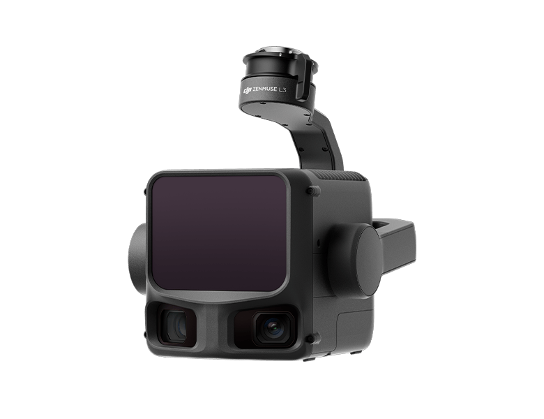
Zenmuse L3[8]
Zenmuse L3 features a 1535nm long-range LiDAR, dual 100MP RGB mapping cameras, and a high-precision POS system. It can be mounted on Matrice 400 using the Zenmuse L3 single gimbal connector, accelerating geospatial data acquisition.
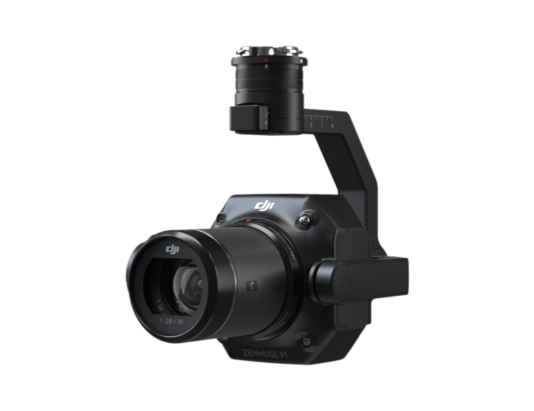
Zenmuse P1[8]
Zenmuse P1 integrates a full-frame sensor with interchangeable fixed-focus lenses on a 3-axis stabilized gimbal. Designed for photogrammetry flight missions, it takes efficiency and accuracy to a whole new level.
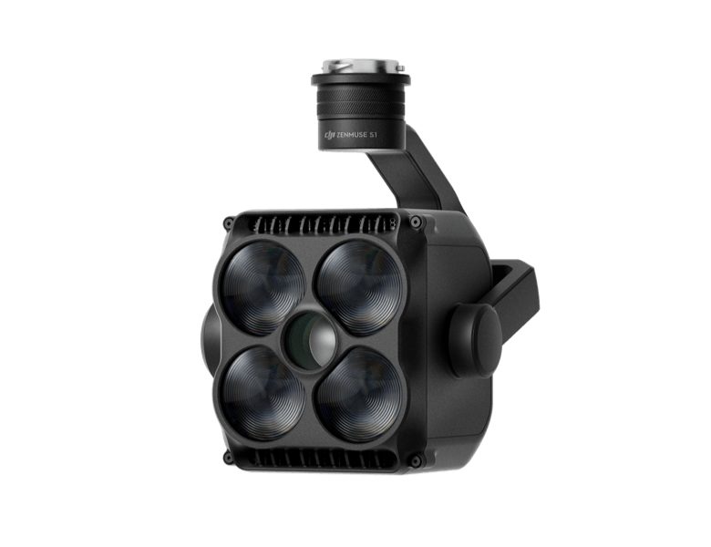
Zenmuse S1[8]
Zenmuse S1 is DJI's first spotlight designed for multi-payload drone platforms. Utilizing the LEP technology, it offers high brightness and long illumination distance, and supports multiple lighting modes. This makes it ideal for public safety, emergency rescue, inspection, and other nighttime operations.
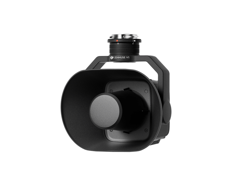
Zenmuse V1[8]
Zenmuse V1 is DJI's first loudspeaker designed for multi-payload drone platforms. It boasts high volume and long broadcast distance, and supports multiple broadcast modes, making it ideal for scenarios like public safety, emergency rescue, and more.
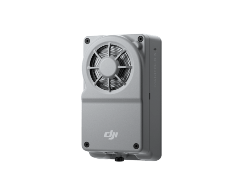
Manifold 3[8]
Manifold 3 packs an impressive 100 TOPS of computing power into a compact unit weighing about 120 g. It can be mounted onto Matrice 400 drone platform, optimizing efficiency across various operational missions with its robust processing.
Estimate the Matrice 400’s flight time based on payload configuration.
Matrice 400 has a protection rating of IP55[9], allowing it to operate reliably in challenging conditions including heavy dust or rain. It also maintains stable performance across temperatures from -20° to 50° C (-4° to 122° F), delivering consistent results in both hot and cold conditions.
The Matrice 400's advanced obstacle sensing system integrates rotating LiDAR, high-precision mmWave radar, and full-color low-light fisheye vision sensors[13] pushing detection capabilities to unprecedented levels. The system detects even small obstacles like high-voltage power lines across mountainous terrain — even in darkness [3],t can penetrate rain and fog to sense its surroundings, providing enhanced safety in challenging weather conditions.
O4 Enterprise Enhanced Video Transmission System
Thanks to the ten-antenna system on the aircraft and the high-gain phased array antenna system on the remote controller, the O4 Enterprise Enhanced Video Transmission System can achieve image transmission up to 40 km [10].
Matrice 400 also supports the sub2G frequency band [5], and when equipped with two DJI Cellular Dongle 2 [11], it can automatically switch to the better available carrier network, providing a more stable signal even in urban interference environments or remote regions.
Airborne Relay Video Transmission [5]
Matrice 400 has a built-in video transmission relay module. With this setup, one Matrice 400 can serve as a relay drone, flying high to provide relay signals for another Matrice 400 operating at a greater distance. This capability significantly extends the transmission range, making it ideal for search and rescue tasks as well as inspections in mountainous areas.
The omnidirectional sensing performance [12] brought by rotating LiDAR, high-precision mmWave radar, and full-color low-light fisheye vision sensors provides Matrice 400 with strong positioning capabilities. It can fly stably close to glass-facade buildings or wind turbine blades and safely return from building edges, mountain bases, or bridge sides even when the return point has not been updated.
With Zenmuse H30 Series' visible and thermal imaging, Matrice 400 can detect vehicles, vessels, and subjects during search and rescue operations or routine flights. It also supports switching to other models, enabling the expansion of application scenarios. Additionally, it supports high-res grid photos and features powerful tracking capabilities.
Matrice 400 supports Real-Time Terrain Follow flight in any horizontal direction [15]. This feature
can be enabled during both manual flight and automated flight routes, ensuring stable relative height to the
ground.
During large-scale search and rescue operations, the size of ground subjects can be kept
consistent on the remote controller screen, reducing the need for frequent zoom adjustments and improving
efficiency. During mapping missions, a consistent ground sampling distance (GSD) can be maintained to obtain
high-precision mapping data.
To address the needs of offshore operations such as maritime patrol and wind turbine inspection, Matrice 400 is equipped with the capability to take off from and land on ships, supporting takeoff from stationary vessels and landing on moving vessels. By detecting landing point patterns on the deck, it can achieve safe and precise landings.
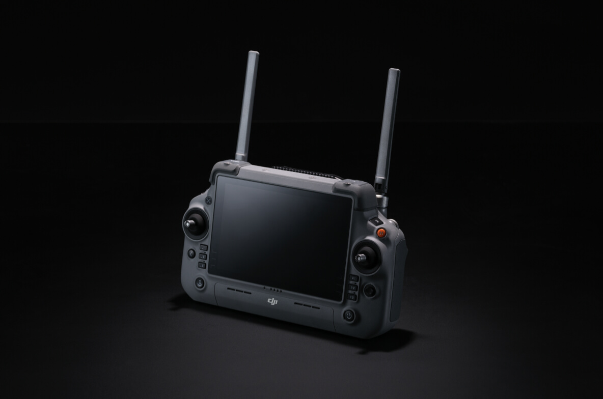
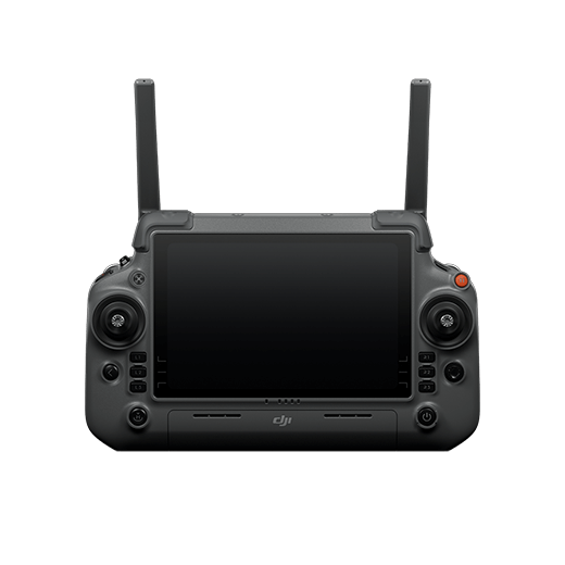
DJI RC Plus 2 Enterprise Enhanced Remote Controller features a new high-brightness screen that remains clearly visible even in direct sunlight. It has an IP54 protection rating and can operate in temperatures ranging from -20° to 50° C (-4° to 122° F). Equipped with the O4 Enterprise Enhanced Video Transmission, it features a built-in high-gain antenna array, providing strong performance. It also supports the sub2G module and 4G hybrid transmission solutions, ensuring stable and smooth video feeds in both urban high-rise and mountainous environments.
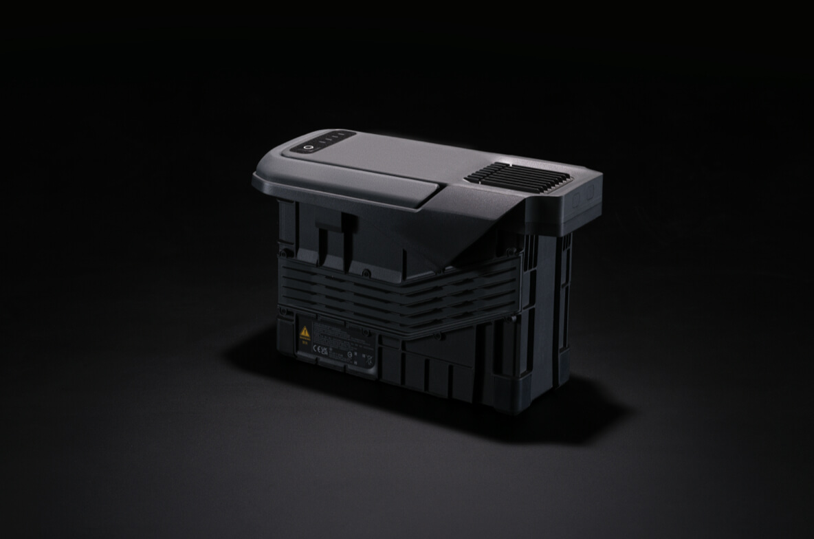
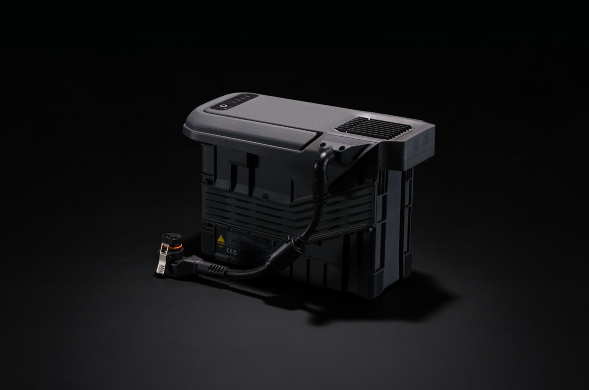
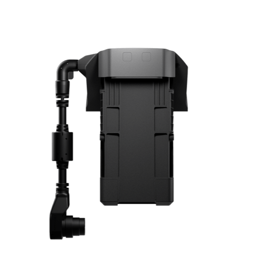
The TB100 Intelligent Flight Battery uses high-performance, high-energy cells and can be charged up to 400 cycles, reducing the cost per flight. It also features enhanced heat dissipation and is equipped with a self-heating system for improved reliability.
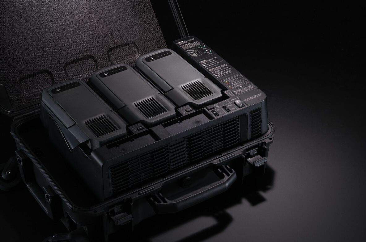
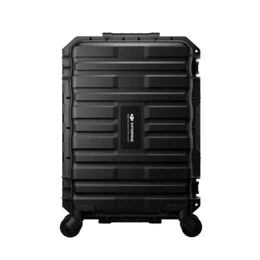
The intelligent battery station is a one-stop solution for battery charging, storage, and transport. It can charge up to three TB100 batteries and two WB37 batteries sequentially. With a fast charging time of just 45 minutes [18] per TB100 battery, it ensures seamless, uninterrupted flight operations. In Silent Mode, noise levels are as low as 36 dB [19].
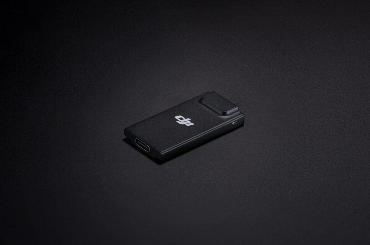
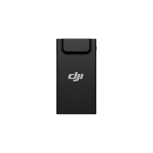
The TB100C Tethered Battery is compatible with third-party tethered lighting and communication products, enabling long-duration aerial lighting and communication base station functions via cable. Reserved ports are available to support third-party development of automated recharging station products, such as drone docks.
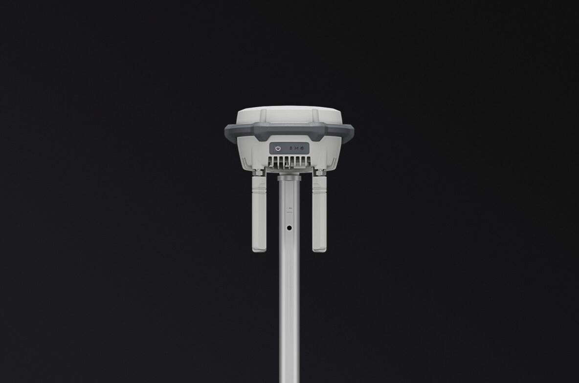
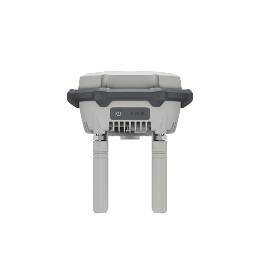
The D-RTK 3 Multifunctional Station can serve as a base station to provide centimeter-level positioning for multiple drones simultaneously. Additionally, the new Rover Station Mode, combined with the DJI Enterprise app and DJI Terra, provides a comprehensive solution for high-precision aerial surveying applications, ensuring accurate operations.

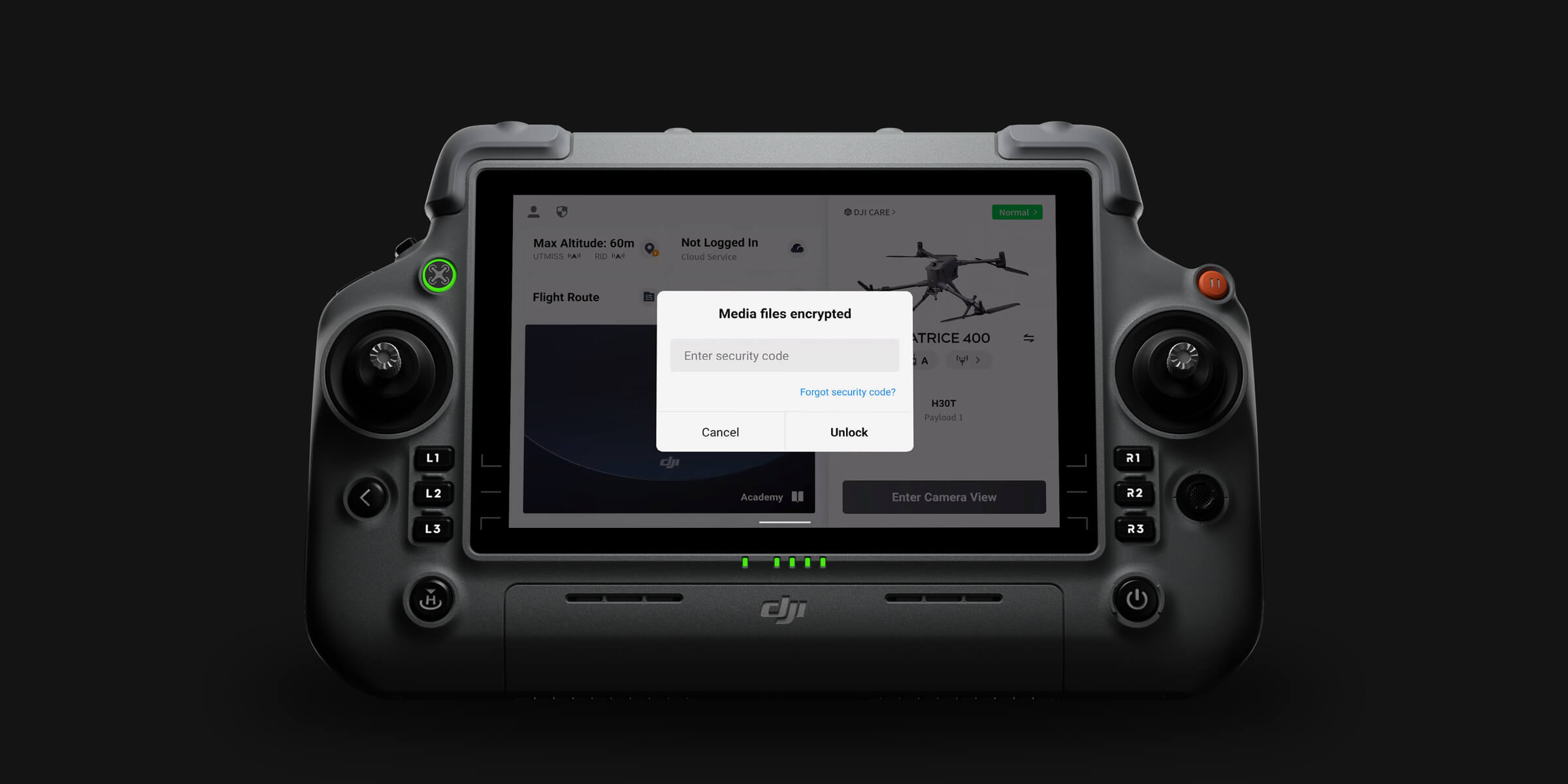
Media Data Encryption

Local Data Mode

One-Tap Clear Logs

AES-256 Video Transmission Encryption

Cloud API
Comprehensive Protection | Professional Quality Assurance | Exclusive Service | Service Starts with Activation
Power Line Inspection
Geographic Information
Oil and Natural Gas
Water Conservation
Maritime
Roads and Bridges


Notes
* Always check and strictly abide by local laws and regulations before flying.
** All data on this page was collected with a production model of DJI Matrice 400 in a controlled test environment. Actual experience may vary depending on the environment, usage, and firmware version.
*** All videos and photos on this page were shot in strict compliance with local laws and regulations. Demos, including wildlife, were shot from a safe distance and are used for reference only. Please observe local laws and regulations and ensure the aircraft has obtained relevant certifications before flying.
**** Before use, Matrice 400 must be activated via the DJI Pilot 2 app.
1. Measured with the aircraft flying forward at a constant speed of 10 m/s in a windless environment at sea level, carrying only the H30T (total weight 10,670 g), and from 100% battery level until 0%. Data is for reference only. Actual experience may vary depending on the environment, usage, and firmware version.
2. The 6 kg payload is measured at the third gimbal connector under sea level conditions. Payload capacity decreases as altitude increases. For details, refer to the official user manual.
3. Power line obstacle sensing capability: When directly facing a transmission line (21.6 mm steel-core aluminum stranded wire), obstacle sensing is supported at speeds up to 25 m/s. When both transmission lines (21.6 mm steel-core aluminum stranded wire) and distribution lines (12 mm steel-core aluminum stranded wire) are present, obstacle sensing is supported at speeds up to 17 m/s. Obstacle sensing performance may vary depending on environmental conditions (such as cloud, fog, rain, or snow), as well as the material, position, and shape of the target object. Due to the limitations of the safety system, the aircraft cannot actively avoid fast-moving objects; please fly with caution in such environments. Refer to the user manual for more information. The mmWave radar function may be unavailable or restricted in some countries or regions. Refer to local laws and regulations for more information.
4. This feature is unavailable in countries or regions without 5GHz frequency support. Refer to local laws and regulations for more information.
5. Operating frequency allowed varies among countries and regions. Refer to local laws and regulations for more information.
6. Measured with the aircraft hovering in a windless environment at sea level, carrying only the H30T (total weight 10,670 g), and from 100% battery level until 0%. Data is for reference only. Actual usage time may vary depending on the environment, usage, and firmware version. Always pay attention to reminders in the app during your flight.
7. The E4 port of E-Port V2 can be expanded into four payload ports via the E-Port Hub expansion plate. For more detailed information, visit https://developer.dji.com/payload-sdk to learn more.
8. Sold separately.
9. Please follow the requirements stated in the IP55 protection rating instructions. Measured in a controlled environment. The IP rating is not permanently effective and may decrease due to product wear and tear.
10. Measured with FCC compliance in an unobstructed environment with low interference at a flight altitude of approximately 120 m. Data is for reference only. During your flight, please pay attention to reminders in the app.
11. To use 4G Enhanced Transmission, the remote controller must be equipped with the DJI Cellular Dongle 2 (sold separately) or connected to the internet via Wi-Fi. This service is not available in some countries and regions. Please consult your local dealer for details.
12. There are certain blind areas of visual sensing and infrared sensing. Positioning and obstacle-sensing performance may be affected by the flight environment and obstacle characteristics. Please fly with caution.
13. When ambient light is below 12 lux, the visual sensor switches to black-and-white mode.
14. Zenmuse H30 Series required.
15. DJI Pilot 2 required.
16. It is recommended to use the feature when the ship speed is below 10 knots and the wind speed is below 5 m/s; exercise caution in other environments. It is recommended to reserve a 3 m × 3 m takeoff and landing space on the deck. Standard landing point pattern files are available on the download page.
17. The following accessories are all compatible with Matrice 400.
18. Charging time is measured based on a 220-volt voltage.
19. Measured in a controlled environment. Results may vary depending on the environment, actual use, and firmware version.
20. Service offerings may vary by country or region. For details, please consult your local dealer. Free Repairs: Get free repairs within the coverage scope and amount; Coverage for Your Whole Fleet: Shared coverage can be extended to other DJI Enterprise devices bound to DJI Care Enterprise Plus within the same time period (30 calendar days) after the first activation and binding; Free Shipping: Available in regions covered by DJI Care Enterprise. Users are responsible for additional costs including logistics and customs duties incurred beyond the scope of coverage. The official extended warranty covers the following components: aircraft body, intelligent battery station, remote controller, single downward gimbal module, dual downward gimbal module, and third gimbal connector.
21. Measured with the aircraft flying forward at a constant speed of 10 m/s in a windless environment at sea level, carrying different individual payloads, and from 100% battery level until 0%. Data is for reference only. Actual experience may vary depending on the environment, usage, and firmware version. Always pay attention to reminders in the app during your flight.